TWO YEARS OF MAPPING MANILA’S PERI-URBAN FRINGE: THE “SPACES IN TRANSITION” PROJECT
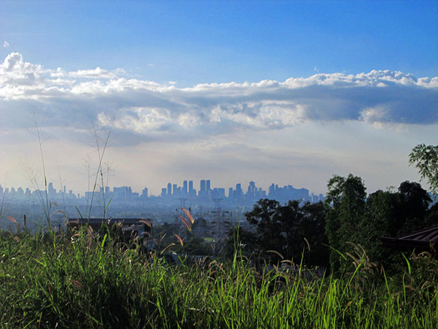
A view of Metropolitan Manila on the horizon, as seen from a gated and exclusive subdivision in Barangay Dolores, Taytay, Rizal, represents the distance between the city and the peri-urban fringe: far enough for a home secluded in “rural”-like conditions, but near enough to travel to for work on a day-to-day basis.
The “Spaces in Transition: Mapping Manila’s Peri-Urban Fringe” aims to map the rapid spatial transformation of areas surrounding Metro Manila, or what is called the peri-urban finge. Through the use of mixed research methodologies, the study explored how land growth and development have affected the residents living in these peri-urban areas.
Data collection techniques include use of historical data papers, selected archival documents and demolition data, as well as a survey and ethnography. The “Spaces in Transition” time-space diary survey, which utilized multi-stage stratified sampling, has gathered information from 2,085 respondents in Rizal, Cavite and Laguna. The survey collected information on different types of mobility (residential, commuting, and regularity of mobility, i.e., daily, weekly, monthly, and seasonal mobility) of all members of the household, their socio-economic characteristics, and belongingness and collective efficacy. While the field teams conducted the survey, they were able to immerse and write their reflections and observations of the peri-urban region over a period of five months.

Barangay Lecheria in Calamba provides a glimpse of the stark reality of urbanization in parts of Laguna: dense agricultural landscapes are punctuated with mixed land use and real estate developments that have implications on local and migratory populations.
“Spaces in Transition” is an OVPAA-funded project based in UPPI under the leadership of Dr. Arnisson Andre Ortega. It has been added to and is featured on the Relational Poverty Network. Recently, it has also partnered with Project Bakawan, a collaborative art event for environment and sustainability awareness, and will hold an interactive audio-visual exhibit at the UP Vargas Museum on March 12, 2015.
Now on its second year of implementation, it hopes to continue spurring public interest in population, development, urbanization, and migration. Currently, project updates and select information from secondary data are available on Facebook, with a separate website featuring survey results and other findings in the pipeline.

A white cow peacefully grazes on an open field, with a row of houses in a real estate development site as the background. These types of sights and landscapes are seen in various pockets of Manila's peri-urban fringe, where the sprawl of urbanization has seen the rise of mixed land uses, fencing or gating of private lands, conversions of agricultural land to industrial, commercial and real estates, and other land developments that shape the everyday spaces of residents.

A billboard facing the highway contrasts with the rural foreground of those living in the community nearby, implying that the process of urbanization in the peri-urban fringe does not translate to homogeneous urbanism.